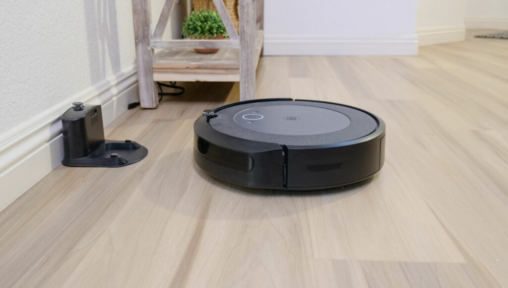
Lidar and VSLAM are two popular navigation methods used in robot vacuums. Lidar, which stands for Light Detection and Ranging, uses lasers to build an accurate 3D map of a room and avoid obstacles. On the other hand, VSLAM, which stands for Visual Simultaneous Localization and Mapping, uses cameras and algorithms to scan a room and navigate the space. Both technologies have their advantages and disadvantages, and it’s important to understand how they work to make an informed decision when choosing a robot vacuum. In this article, we are going to do a comparison of Lidar vs Vslam.
Lidar technology is reliable and accurate, making it a popular choice for autonomous vehicles. It can detect obstacles, furniture, and even reflective objects and can build a 3D map of the environment for the robot vacuum to navigate. However, Lidar technology can be costly, and the robot vacuum may require a powerful battery to support the laser sensor. VSLAM technology, on the other hand, is cheaper and can be used with optical sensors, motion sensors, and inertial measurement units (IMU) to detect the robot or indoor robotic vacuum cleaner’s position.
VSLAM technology can also be combined with AI and machine learning algorithms to improve navigation and create virtual boundaries. However, VSLAM technology may be less accurate than Lidar, especially in low light conditions, and may struggle with geometric distortions and reprojection errors.
[lwptoc]
You may also like
- How Robot Vacuums Work: A Comprehensive Guide
- Pros and Cons of a Robot Vacuum: Is It Worth the Investment?
What is lidar?
Lidar, short for Light Detection and Ranging, is a remote sensing technology that uses laser light to measure distances and create a 3D map of the environment. Lidar is widely used in various applications, including self-driving cars, robotics, archaeology, and urban planning.
How lidar works
Lidar emits a laser beam that bounces off objects and returns to the sensor. The time it takes for the laser to return to the sensor is used to calculate the distance to the object. By scanning the laser beam across the scene, Lidar can create a 3D map of feature points in the environment, called a point cloud.
Depending on the application, Lidar sensors can operate at different wavelengths, ranging from ultraviolet to infrared light. Shorter wavelengths provide higher accuracy but have a shorter range, while longer wavelengths have a more extended range but lower accuracy.
Applications of lidar
Lidar has many applications, including:
- Self-driving cars: Lidar is a critical component of autonomous vehicles, providing accurate and reliable distance measurements to detect obstacles and navigate the environment.
- Robotics: Lidar is used in various types of robots, including drones, to navigate and map the environment.
- Archaeology: Lidar can be used to create high-resolution maps of archaeological sites, revealing hidden structures and features.
- Urban planning: Lidar can create accurate 3D city models, helping planners design and manage urban spaces.
Pros and cons of lidar
Lidar has several advantages over other sensing technologies, including:
- High accuracy: Lidar can provide accurate distance measurements with sub-centimetre precision, making it ideal for many applications.
- 3D mapping: Lidar can create detailed 3D maps of the environment, providing valuable information for various industries.
However, Lidar also has some disadvantages, including:
- Cost: Lidar sensors can be expensive, making them less accessible for some applications.
- Limited range: Lidar sensors have a limited range, which can be challenging for some applications requiring long-distance sensing.
Overall, Lidar is a powerful remote-sensing technology with many applications across various industries.
What is VSLAM?
Visual Simultaneous Localization and Mapping (VSLAM) is a navigation method that uses optical sensors, such as cameras, to create a 3D map of an environment while simultaneously determining the device’s position within that environment. VSLAM is a type of SLAM (Simultaneous Localization and Mapping) technology which is used to create a map of an unknown environment while tracking the device’s position.
How VSLAM works
VSLAM uses a camera, often paired with an Inertial Measurement Unit (IMU), to capture images of an environment. Algorithms then process these images to create a 3D map of the environment. As the device moves through the environment, the algorithms use the images captured by the camera to determine the device’s position and orientation within the environment.
Applications of VSLAM
VSLAM has many applications, including robotics, virtual reality, and augmented reality. In robotics, VSLAM is used to help autonomous robots navigate through unknown environments. In virtual reality, VSLAM creates immersive experiences by tracking the user’s position and orientation within a virtual environment. In augmented reality, VSLAM is used to overlay digital information onto the real world by tracking the user’s position and orientation within the environment.
VSLAM has several advantages over other navigation methods, such as Lidar. VSLAM is less expensive than Lidar, as it uses only a camera and an IMU, which are inexpensive components. VSLAM is also more accurate than other navigation methods, as it can create a highly detailed 3D map of an environment. However, VSLAM has some limitations, such as its reliance on visual data, which can be affected by lighting conditions and occlusions.
In conclusion, VSLAM is a powerful navigation method that has a wide range of applications. Its ability to create a detailed 3D map of an environment while simultaneously tracking the device’s position and orientation makes it an ideal choice for robotics, virtual reality, and augmented reality applications. While VSLAM has some limitations, such as its reliance on visual data, its advantages make it a popular choice for many applications.
Lidar vs VSLAM
Regarding robot navigation and mapping, two popular technologies are LiDAR and VSLAM. Both have pros and cons; choosing the right technology depends on the specific application needs. This section will compare LiDAR and VSLAM based on accuracy, cost, reliability, navigation technology, obstacle detection, and mapping capabilities.
Accuracy
LiDAR is known for its high accuracy and precision. It can detect objects at a distance of up to 100 meters and can generate a 3D map of the environment. VSLAM, on the other hand, relies on visual data and can be less accurate in low-light conditions or when there are too many reflective surfaces.
Cost
LiDAR systems can be expensive, ranging from hundreds to thousands of dollars. VSLAM, on the other hand, can be implemented using a standard RGB camera and an inertial measurement unit (IMU), making it a more cost-effective solution.
Reliability
LiDAR is a mature technology used in various applications for many years. It is known for its reliability and robustness in different environmental conditions. VSLAM, on the other hand, is a relatively new technology and may still have some limitations in specific scenarios.
Navigation technology
LiDAR uses laser beams to scan the environment and create a 3D map, while VSLAM relies on visual data to estimate the robot’s position and orientation. LiDAR can be used for indoor and outdoor navigation, while VSLAM is more suitable for indoor environments with good lighting conditions.
Obstacle detection
LiDAR can detect obstacles with high accuracy and generate a 3D map of the environment, making it easier for robots to avoid collisions. VSLAM, however, may have some limitations in detecting transparent or reflective surfaces.
Mapping capabilities
LiDAR can generate a 3D environment map with high accuracy and precision using motion sensor data, while VSLAM can generate a 2D map of the environment using visual data. LiDAR is more suitable for applications that require high-precision mapping, while VSLAM may be more appropriate for applications that require real-time mapping.
In conclusion, both LiDAR and VSLAM have their strengths and weaknesses, and the choice of technology depends on the specific application needs. LiDAR is more accurate and reliable but expensive, while VSLAM is more cost-effective but may have some limitations in certain scenarios.
Recommendations
Remember a few recommendations when choosing between Lidar and VSLAM for your robot vacuum. Here are some factors to consider when making your decision:
Brand considerations
If you’re looking for older robotic vacuum cleaners or a reliable brand, Roomba, Neato, Xiaomi, and Roborock are all great options. Each brand offers robot vacuums with both Lidar and VSLAM navigation systems. However, the specific features and prices may vary between models.
Navigation system
Lidar-based robot vacuums are generally more accurate and faster at mapping your home, while VSLAM-based robotic vacuums are better at handling obstacles and navigating tight spaces. Consider the layout of your home and the obstacles your robot vacuum will encounter when deciding which navigation system to choose.
Additional features
Some robot vacuums have additional features like Alexa compatibility, motion sensors, and mopping capabilities. If these features are important to you, look for a robot vacuum that includes them.
Battery life
Battery life is an important factor to consider, especially if you have a large home or want your robot vacuum to clean multiple rooms in one go. Look for a robot vacuum with long battery life and quick charging time.
Pros and cons
Here are some pros and cons of Lidar and VSLAM navigation systems to keep in mind:
Lidar pros:
- More accurate mapping
- Faster initial mapping
- Better at sticking to virtual boundaries
Lidar cons:
- More expensive
- May struggle with dark surfaces
VSLAM pros:
- Better at handling obstacles and tight spaces
- Less expensive
- It may work better on dark surfaces
VSLAM cons:
- Slower initial mapping
- May struggle with virtual boundaries
Conclusion
Nevertheless, each technology comes with its own set of challenges. For example, visual SLAM technology might require more expensive equipment than LiDAR-based SLAM, and LiDAR systems may struggle with obstacles that don’t reflect light effectively. Also, the efficient performance of VSLAM vacuums can be hampered by lighting conditions, while LiDAR systems might be less effective in overly cluttered environments.
The choice between LiDAR and VSLAM robot vacuums thus depends on each robotics application’s specific requirements and constraints. Overall, the decision between Lidar and VSLAM comes from your specific needs and preferences. Consider the abovementioned factors and choose the robot vacuum that best fits your home and lifestyle.